About
Why is information on burned areas needed?
It is estimated, that about 25%-35% of Greenhouse gases (GHG) result from biomass burning and therefore they are considered an important factor in climate change (GTOS 68, T13 Fire Disturbance).
Aims of the FireCCI project
Current global burned area products already exist, but the FireCCI project aims to improve consistency, using better algorithms for both pre-processing and burned area detection while incorporating error characterisation in their product.
The project team, led by University of Alcala (Spain), focuses on the following issues relating to Fire disturbance:
- Analysis and specification of scientific requirements relating to climate
- Development and improvement of pre-processing and burned area algorithms
- Inter-comparison and selection of burned area algorithms
- System prototyping and production of burned area datasets
- Product validation and product assessment
More specifically, the project team aims to:
- Develop and validate algorithms to meet, as far as possible, GCOS Essential Climate Variable (ECV) requirements for (consistent, stable, error-characterized) global satellite data products from multi-sensor data archives
- Produce and validate, within a research and development context, the most complete and consistent possible time series of multi-sensor global satellite data products for climate research and modelling
- Optimise the impact of ESA Earth Observation (EO) missions data on climate data records
- Strengthen inter-disciplinary cooperation between international earth observation, climate research and modelling communities, in pursuit of scientific excellence.
The project focuses on the key variable "burned area". It will incorporate active fire observations as a supplemental variable to improve detection of burned area across varying biomes.
Global Burned Area products – Output of the FireCCI Project
Global burned area products are delivered in two formats as a result of the project:
- Pixel product, with a resolution of 250-300 metres, including the date of detection, the confidence level and the land cover corresponding to the burned pixel. Each dataset contains one month of information, and it is divided in 6 sub-continental GeoTIFF files.
- Grid product, with a resolution of 0.25 degrees, and the following information in each grid cell: sum of burned area, standard error, fraction of burnable area, fraction of observed area, and sum of burned area for each land cover class.
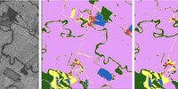
Complementary, a Small Fire Dataset (SFD) product has been generated, using Sentinel-2 information at 20-metre spatial resolution, and covering Sub-Saharan Africa for the years 2016 and 2019. As additional information, a test burned area derived from Sentinel-1 has also been obtained for Tropical South America. Three test sites in Siberia, Sahel and the Amazon are being used to produce a burned area product combining the long time series of Landsat and Sentinel-2.
Data
Burned Area Products
As part of the Fire_cci project, several algorithms have been or are being tested in different parts of the world, involving the use of medium to high resolution satellite images, including MERIS, MODIS, Sentinel 1, Sentinel 2, Sentinel-3 and AVHRR data.
The following burned area products have been produced:
| Product | Coverage | Time series | Input data (sensor) | Spatial Resolution | Publication | Publication DOI | ||
|---|---|---|---|---|---|---|---|---|
| Surface reflectance | Active fires | Pixel | Grid | |||||
| FireCCIS311 | Global | 2019-2022 | Sentinel-3 SYN (based on OLCI and SLSTR) v1.1 | VIIRS | 300m | 0.25 deg | Lizundia-Loiola, J., Franquesa, M., Khairoun, A., Chuvieco, E. (2022) Global burned area mapping from Sentinel-3 Synergy and VIIRS active fires. Remote Sensing of Environment 282, 113298. | https://doi.org/10.1016/j.rse.2022.113298 |
| FireCCI51 | Global | 2001-2020 | MODIS | MODIS | 250 m | 0.25 deg | Lizundia-Loiola, J., et al. (2020) A spatio-temporal active-fire clustering approach for global burned area mapping at 250 m from MODIS data. | https://doi.org/10.1016/j.rse.2019.111493 |
| FireCCILT11 | Global | 1982-2018 (minus 1994) | AVHRR LTDR | - | 0.05 deg | 0.25 deg | Otón, G., et al. (2021) Development of a consistent global long-term burned area product (1982–2018) based on AVHRR-LTDR data. | https://doi.org/10.1016/j.jag.2021.102473 |
| FireCCISFD20 | Sub-Saharan Africa | 2019 | Sentinel-2 A&B MSI | VIIRS | 20 m | 0.05 deg | Chuvieco, E., et al. (2022) Building a small fire database for Sub-Saharan Africa from Sentinel-2 high-resolution images. | https://doi.org/10.1016/j.scitotenv.2022.157139 |
| FireCCISFD11 | Sub-Saharan Africa | 2016 | Sentinel-2 A MSI | MODIS | 20 m | 0.25 deg | Roteta, E., et al. (2019) Development of a Sentinel-2 burned area algorithm: Generation of a small fire database for sub-Saharan Africa. | https://doi.org/10.1016/j.rse.2018.12.011 |
| FireCCISFDL10 | Test sites: Amazon, Sahel and Siberia | 1990-2019 | Landsat 4-5-7-8 TM, ETM+, OLI | - | 30 m | - | - | - |
| FireCCIS1SA10 (beta product) | Amazon basin | 2017 | Sentinel-1 SAR | - | 40 m | - | Belenguer-Plomer, M.A., et al. (2019) Burned area detection and mapping using Sentinel-1 backscatter coefficient and thermal anomalies. | https://doi.org/10.1016/j.rse.2019.111345 |
| FireCCI Special study case Indonesia | Indonesia | 2015-2016 | Sentinel-1 SAR | - | 10 m | - | Lohberger, S. et al. (2018) Spatial evaluation of Indonesia's 2015 fire-affected area and estimated carbon emissions using Sentinel-1. | https://doi.org/10.1111/gcb.13841 |
| FireCCI50 (deprecated) | Global | 2001-2016 | MODIS | MODIS | 250 m | 0.25 deg | Chuvieco, E., et al. (2018) Generation and analysis of a new global burned area product based on MODIS 250 m reflectance bands and thermal anomalies. | https://doi.org/10.5194/essd-10-2015-2018 |
| FireCCIS310 (deprecated) | Global | 2019 | Sentinel-3 SYN (based on OLCI and SLSTR) | VIIRS | 300 m | 0.25 deg | Lizundia-Loiola, J., Franquesa, M., Khairoun, A., Chuvieco, E. (2022) Global burned area mapping from Sentinel-3 Synergy and VIIRS active fires. Remote Sensing of Environment 282, 113298. | https://doi.org/10.1016/j.rse.2022.113298 |
| FireCCI41 (deprecated) | Global | 2005-2011 | MERIS | MODIS | 300 m | 0.25 deg | Chuvieco, E., et al. (2016) A new global burned area product for climate assessment of fire impacts. | https://doi.org/10.1111/geb.12440 |
| FireCCI31 (deprecated) | Global | 2006-2008 | MERIS | MODIS | 300 m | 0.5 deg | Alonso-Canas, I., Chuvieco, E. (2015) Global Burned Area Mapping from ENVISAT-MERIS data. | https://doi.org/10.1016/j.rse.2015.03.011 |
| FireCCILT10 (deprecated) | Global | 1982-2017 (minus1994) | AVHRR LTDR | - | - | 0.25 deg | Otón, G., et al. (2019) Global detection of long-term (1982-2017) burned area with AVHRR-LTDR data. | https://doi.org/10.3390/rs11182079 |
Ancillary Datasets
BARD: Burned Area Reference Database: global and regional reference fire perimeters used for the validation of burned area products
Key Documents
Autres documents
Team
The University of Alcala (UAH) has formed a group of research institutions, technology partners and companies in order to carry out the FireCCI project in an optimum way. The whole group and its partners is referred to as the FireCCI project team.
The scientific and industrial consortium of the FireCCI team for the new Phase of the Programme (called CCI+) consists of the following partners, which are shortly described below with their experience and proposed roles.
UAH is the lead partner and the scientific coordinator of the activities of its partners.
Specific groups of partners are set-up to address specific tasks
- Earth Observation Science Group
- System Engineers
- Climate Research Group
Earth Observation Science Team
UAH, University of Alcala (Spain) is the project science leader partner as well as the project manager, and has developed burned area (BA) algorithms for coarse-resolution sensors based on MERIS, MODIS, AVHRR, Sentinel-3 OLCI and SYN products, Sentinel-1 for the Amazon Basin, and for a combination of Sentinel-1 and Sentinel-2 data for test sites in Africa.
Universidad Politécnica de Madrid (UPM, Spain) is developing algorithms for merging burned area products into a consistent multi-sensor product.
National Research Council of Italy - Institute for Electromagnetic Sensing of Environment (CNR - IREA, Italy) is in charge of the validation of the burned area products.
System Engineers
Brockmann Consult GmbH (BC, Germany) is responsible for the system engineering and BA production.
Climate Research Group
National Centre for Scientific Research (CNRS, France) works on user requirements analysis and the assessment of the quality of the BA products for their application in carbon cycling and DGVM fire models.
Vrije Universiteit Amsterdam (VU, Netherlands) works on the assessment of the FireCCI products on emission estimates using the GFED modelling framework.
During the previous phases of the project, the following partners were also members of the FireCCI Project Team:
- Max Planck Institute for Meteorology (MPIM, Germany)
- University of the Basque Country (EHU, Spain)
- University of Leicester (UL, United Kingdom)
- University College London (UCL, United Kingdom)
- School of Agriculture, University of Lisbon (ISA, Portugal)
- Max Planck Institute for Chemistry (MPIC, Germany)
- Research Institute for Development (IRD, France)
- Stichting VU-VUmc (VUA, Netherlands)
- Remote Sensing Solutions GmbH (RSS, Germany)
- Université Catholique de Louvain (UCL, Belgium)
- GAF AG, Munich (Germany)
- DLR – Deutsches Zentrum für Luft- und Raumfahrt (Germany), Applied Remote Sensing Cluster
- GMV AEROSPACE & DEFENCE (Madrid/Spain)
- JÜLICH – Forschungszentrum Jülich GmbH (Germany)
- INIA – Instituto Nacional de Tecnologia Agraria y Alimentaria, Remote Sensing Research Group: Fire and Earth observation scientific expertise (Spain)
User Groups
Users for the FireCCI products are identified in the Statement of Work of this Project. Basically these are the wider Climate Research Community. This group is understood as the drivers in the CCI and therefore play the single most important role. The users are considered in the project not only with the engaged climate modellers within the project team. They are also consulted via a structured dialogue with the Climate Modelling User Group (CMUG) - see below. Other external users are also invited to assess and evaluate the FireCCI algorithms and products via collaboration with our Climate Research Group. The Users can be grouped in:
Climate Modelling User Group (CMUG) – consists of notable European institutions representing an interface of the CCI Programme and the wider Climate Research Community. The CMUG is intended as a structured forum allowing for discussion and inter-comparison of assessment methods, agreement on best practices and common standards, and multi-disciplinary assessments of the consistency, error characteristics and impacts of the global data products generated by CCI. CMUG allows for an integrated analysis of all ECVs being addressed in the CCI Programme.
Climate Research Community – has as one of its focus the involvement of the end users of the burned area products that are generated. To reach this objective not only the project internal climate modellers and the Climate Modelling User Group will participate. Also other interested climate modellers are invited to provide their input in the requirements analysis and the data validation. The wider climate research community includes the Climate Modelling User Group and the institutions engaged in the project team as partners.
Other Users – in addition to climate-modelling researchers, other scientists can also benefit from the Fire Disturbance products generated in this project.
Publications
Click on the following links for publications published by the Fire project.
2024 |2023 | 2022 | 2021 | 2020 | 2019 | 2018 | 2017 | 2016 | 2015 | 2014 | 2013
2024
- Khairoun A. Mouillot F., Chen W., Ciais P., Chuvieco E. (2024) Coarse-resolution burned area datasets severely underestimate fire-related forest loss. Science of the Total Environment 920, 170599. https://doi.org/10.1016/j.scitotenv.2024.170599.
2023
- Haliuc, A., Daniau, AL., Mouillot, F., Chen, W., Leys, B., David, V., Hanquiez, V., Dennielou, B., Schefuss, E., Bayon, G., Crosta, X. (2023) Microscopic charcoals in ocean sediments off Africa track past fire intensity from the continent. Communications Earth & Environment 4, 133. https://doi.org/10.1038/s43247-023-00800-x
- Meryeme Boumahdi, Angel Mario García-Pedrero, Mario Lillo-Saavedra y Consuelo Gonzalo-Martin. Assimilating Sentinel-3 Spectral Bands with Sentinel-2 to Improve the Quality of Spatio-temporally Fused Images. IEEE Journal of Selected Topics in Applied Earth Observation and Remote Sensing 17, p. 584-600. DOI: 10.1109/JSTARS.2023.3333275.
- Pinardi M., Stroppiana D., Caroni R., Parigi L., Tellina G., Free G., Giardino C., Albergel C., Bresciani M. (2023) Assessing the impact of wildfires on water quality using satellite remote sensing: The lake baikal case study. Front. Remote Sens 4:1107275, https://doi.org/10.3389/frsen.2023.1107275
- Zheng, B., Ciais, P., Chevallier, F., Yang, H., Canadell, J.G., Chen, Y., van der Velde, I.R., Aben, I., Chuvieco, E., Davis, S.J., Deeter, M., Hong, C., Kong, Y., Li, H., Li, H., Lin, X., He, K., Zhang, Q. (2023) Record-high CO2 emissions from boreal fires in 2021. Science 379 (6635), 912-917. https://doi.org/10.1126/science.ade0805
2022
- Chuvieco, E., Roteta, E., Sali, M., Stroppiana, D., Boettcher, M., Kirches, G., Storm, T., Khairoun, A., Pettinari, M.L., Franquesa, M., Albergel, C. (2022) Building a small fire database for Sub-Saharan Africa from Sentinel-2 high-resolution images. Science of the Total Environment 845, 157139, https://doi.org/10.1016/j.scitotenv.2022.157139
- Franquesa, M., Lizundia-Loiola, J., Stehman, S.V., Chuvieco, E. (2022). Using long temporal reference units to assess the spatial accuracy of global satellite-derived burned area products. Remote Sensing of Environment 269, 112823, https://doi.org/10.1016/j.rse.2021.112823
- Franquesa, M., Rodriguez-Montellano, A.M., Chuvieco, E., Aguado, I. (2022) Reference Data Accuracy Impacts Burned Area Product Validation: The Role of the Expert Analyst. Remote Sensing 14(17), 4354; https://doi.org/10.3390/rs14174354
- Franquesa, M., Stehman S.V., Chuvieco, E. Assessment and characterization of sources of error impacting the accuracy of global burned area products. Remote Sensing of Environment, 280, 113214, https://doi.org/10.1016/j.rse.2022.113214
- García, M.; Pettinari, M.L.; Chuvieco, E.; Salas, J.; Mouillot, F.; Chen, W.; Aguado, I. (2022) Characterizing Global Fire Regimes from Satellite-Derived Products. Forests, 13, 699. https://doi.org/10.3390/f13050699
- Hegglin M. I., Bastos A., Bovensmann H., Buchwitz M., Fawcett D., Ghent D., Kulk G., Sathyendranath S., Shepherd T. G., Quegan S., Röthlisberger R., Briggs S., Buontempo C., Cazenave A., Chuvieco E., Ciais P., Crisp D., Engelen R., Fadnavis S., Herold M., Horwath M., Jonsson O., Kpaka G., Merchant C. J., Mielke C., Nagler T., Paul F., Popp T., Quaife T., Rayner N. A., Robert C., Schröder M., Sitch S., Venturini S., van der Schalie R., van der Vliet M., Wigneron J.-P., Woolway R. I. (2022) Space-based Earth observation in support of the UNFCCC Paris Agreement. Frontiers in Environmental Science 10:941490. https://doi.org/10.3389/fenvs.2022.941490
- Lizundia-Loiola, J., Franquesa, M., Khairoun, A., Chuvieco, E. (2022) Global burned area mapping from Sentinel-3 Synergy and VIIRS active fires. Remote Sensing of Environment 282, 113298. https://doi.org/10.1016/j.rse.2022.113298
- Majdalani, G., Koutsias, N., Faour, G., Adjizian-Gerard, J., Mouillot, F. (2022) Fire Regime Analysis in Lebanon (2001–2020): Combining Remote Sensing Data in a Scarcely Documented Area. Fire 5(5), 141. https://doi.org/10.3390/fire5050141
- Stroppiana, D., Sali, M., Busetto, L., Boschetti, M., Ranghetti, L., Franquesa, M., Pettinari, M.L., Chuvieco, E. (2022). Sentinel-2 sampling design and reference fire perimeters to assess accuracy of Burned Area products over Africa for the year 2019. ISPRS Journal of Photogrammetry and Remote Sensing 191, 223-234, https://doi.org/10.1016/j.isprsjprs.2022.07.015
- van Wees, D., van der Werf, G.R., Randerson, J.T., Rogers, B.M. Chen, Y., Veraverbeke, S., Giglio, L., Morton, D.C. (2022) Global biomass burning fuel consumption and emissions at 500 m spatial resolution based on the Global Fire Emissions Database (GFED). Geoscientific Model Development 15(22):8411-8437. https://doi.org/10.5194/gmd-15-8411-2022.
2021
- Belenguer-Plomer, M.A., Tanase, M.A., Chuvieco, E., Bovolo, F. (2021) CNN-based burned area mapping using radar and optical data. Remote Sensing of Environment, 260, 112468, https://doi.org/10.1016/j.rse.2021.112468.
- Chuvieco, E., Pettinari, M.L., Koutsias, N., Forkel, M., Hatson, S., Turco, M. (2021) Human and climate drivers of global biomass burning variability. Science of the Total Environment 779, 146361, https://doi.org/10.1016/j.scitotenv.2021.146361
- Genet, M., Daniau, A-L., Mouillot, F., Hanquiez, V., Schmidt, S., David, V., Georget, M., Abrantes, F. (2021) Modern relationships between microscopic charcoal in marine sediments and fire regimes on adjacent landmasses to refine the interpretation of marine paleofire records: An Iberian case study. Quaternary Science Reviews 270, 107148, https://doi.org/10.1016/j.quascirev.2021.107148
- Hao, W. M., Reeves, M. C., Baggett, L. S., Balkanski, Y., Ciais, P., Nordgren, B. L., Petkov, A., Corley, R. E., Mouillot, F., Urbanski, S. P., and Yue, C. (2021) Wetter environment and increased grazing reduced the area burned in northern Eurasia: 2002–2016. Biogeosciences 18, 2559–2572, https://doi.org/10.5194/bg-18-2559-2021
- Lizundia-Loiola, J., Franquesa, M., Boettcher, M., Kirches, G., Pettinari, M.L., Chuvieco, E. (2021) Implementation of the Burned Area Component of the Copernicus Climate Change Service: From MODIS to OLCI Data. Remote Sensing 13 (21), 4295, https://doi.org/10.3390/rs13214295
- Moreno, M.V., Laurent, P., Mouillot, F. (2021) Global intercomparison of functional pyrodiversity from two satellite sensors. International Journal of Remote Sensing 42 (24), 9523-9541, https://doi.org/10.1080/01431161.2021.1999529
- Otón, G., Franquesa, M., Lizundia-Loiola, J., & Chuvieco, E. (2021). Validation of low spatial resolution and no-dichotomy global long-term burned area product by Pareto boundary. In: Earth Resources and Environmental Remote Sensing/GIS Applications XII, 1186313, 293-299: SPIE. https://doi.org/10.1117/12.2599883
- Otón, G., Lizundia-Loiola, J., Pettinari, M.L., Chuvieco, E. (2021) Development of a consistent global long-term burned area product (1982–2018) based on AVHRR-LTDR data. International Journal of Applied Earth Observation and Geoinformation 103, 102473, https://doi.org/10.1016/j.jag.2021.102473
- Otón, G., Pereira, J.M.C., Silva, J.M.N., Chuvieco, E. (2021) Analysis of trends in the FireCCI global long term burned area product (1982-2018). Fire 4(4), 74, https://doi.org/10.3390/fire4040074
- Ramo, R., Roteta, E., Bistinas, I., Wees, D., Bastarrika, A., Chuvieco, E. & van de Werf, G. (2021) African burned area and fire carbon emissions are strongly impacted by small fires undetected by coarse resolution satellite data. PNAS 118 (9) e2011160118, https://doi.org/10.1073/pnas.2011160118
- Roteta, E., Bastarrika, A., Franquesa, M., Chuvieco E. (2021) Landsat and Sentinel-2 based burned area mapping tools in Google Earth Engine. Remote Sensing 13 (4), 816, https://doi.org/10.3390/rs13040816.
- Zheng, B., Ciais, P., Chevallier, F., Chuvieco, E., Chen, Y, Yang, H. (2021) Increasing forest fire emissions despite the decline in global burned area. Sciences Advances 7 (39): eabh2646, https://doi.org/10.1126/sciadv.abh2646
2020
- Bowman, D., Williamson, G., Yebra, M., Lizundia-Loiola, J., Pettinari, M.L., Shah, S., Bradstock, R., Chuvieco, E. (2020) Wildfires: Australia needs a national monitoring agency. Nature 584, 188-191, https://doi.org/10.1038/d41586-020-02306-4
- Chuvieco, E., Aguado, I., Salas, J., García, M., Yebra, M., & Oliva, P. (2020) Satellite Remote Sensing Contributions to Wildland Fire Science and Management. Current Forestry Reports 6, 81–96, https://doi.org/10.1007/s40725-020-00116-5
- Franquesa, M., Vanderhoof, M.K., Stavrakoudis, D., Gitas, I.Z., Roteta, E., Padilla, M., Chuvieco, E. (2020) Development of a standard database of reference sites for validating global burned area products. Earth System Science Data 12, 3229-3246, https://doi.org/10.5194/essd-12-3229-2020
- Lizundia-Loiola, J., Otón, G., Ramo, R., Chuvieco, E. (2020) A spatio-temporal active-fire clustering approach for global burned area mapping at 250 m from MODIS data. Remote Sensing of Environment 236, 111493, https://doi.org/10.1016/j.rse.2019.111493
- Lizundia-Loiola, J., Pettinari, M. L., Chuvieco, E. (2020) Temporal Anomalies in Burned Area Trends: Satellite Estimations of the Amazonian 2019 Fire Crisis. Remote Sensing 12 (1), 151, https://doi.org/10.3390/rs12010151.
- Moreno, M.V., Laurent, P., Ciais, P., Moillot, F. (2020) Assessing satellite-derived fire patches with functional diversity trait methods. Remote Sensing of Environment 247, 111897, https://doi.org/10.1016/j.rse.2020.111897
- Popp, T., Hegglin, M.I., Hollmann, R., Ardhuin, F., Bartsch, A., Bastos, A., Bennett, V., Boutin, J., Brockmann, C., Buchwitz, M., Chuvieco, E., Ciais, P., Dorigo, W., Ghent, D., Jones, R., Lavergne, T., Merchant, C.J., Meyssignac, B., Paul, F., Quegan, S., Sathyendranath, S., Scanlon, T., Schröder, M., Simis, S.G.H., & Willén, U. (2020) Consistency of satellite climate data records for Earth system monitoring. Bulletin of the American Meteorological Society, https://doi.org/10.1175/BAMS-D-19-0127.1
- Tanase, M.A., Belengher-Plomer, M.A., Roteta, E., Bastarrika, A., Wheeler, J. Fernández-Carrillo, A., Tansey, K., Wiedermann, W., Navratil, P., Lohberger, S., Siegert, F., Chuvierco, E. (2020) Burned Area Detection and Mapping: Intercomparison of Sentinel-1 and Sentinel-2 Based Algorithms over Tropical Africa. Remote Sensing 12 (2), 334, https://doi.org/10.3390/rs12020334.
2019
- Belenguer-Plomer, M.A., Chuvieco, E., Tanase, M.A. (2019) Temporal Decorrelation of C-Band Backscatter Coefficient in Mediterranean Burned Areas. Remote Sensing 11 (22), 2661, https://doi.org/10.3390/rs11222661
- Belenguer-Plomer, M.A., Tanase, M.A., Fernandez-Carrillo, A., Chuvieco, E. (2019) Burned area detection and mapping using Sentinel-1 backscatter coefficient and thermal anomalies. Remote Sensing of Environment 233, 111345, https://doi.org/10.1016/j.rse.2019.111345
- Brennan, J., Gómez-Dans, J.L., Disney, M., and Lewis, P. (2019) Theoretical uncertainties for global satellite-derived burned area estimates. Biogeosciences 16, 3147–3164, https://doi.org/10.5194/bg-16-3147-2019
- Campagnolo, M.L., Oom, D., Padilla, M., Pereira, J.M.C. (2019) A patch-based algorithm for global and daily burned area mapping. Remote Sensing of Environment 232, 111288, https://doi.org/10.1016/j.rse.2019.111288
- Chuvieco, E., Mouillot, F., van der Werf, G.R., San Miguel, J., Tanase, M., Koutsias, N., García, M., Yebra, M., Padilla, M., Gitas, I., Heil, A., Hawbaker, T.J., Giglio, L. (2019) Historical background and current developments for mapping burned area from satellite Earth observations. Remote Sensing of Environment 225, 45-64, https://doi.org/10.1016/j.rse.2019.02.013
- Forkel, M., Andela, N., Harrison, S.P., Lasslop, G., van Marle, M., Chuvieco, E., Dorigo, W., Forrest, M., Hantson, S., Heil, A., Li, F., Melton, J., Sitch, S., Yue, C., Arneth, A. (2019) Emergent relationships on burned area in global satellite observations and fire-enabled vegetation models. Biogeosciences 16, 57-76, https://doi.org/10.5194/bg-16-57-2019
- Forkel, M., Dorigo, W.A., Lasslop, G., Chuvieco, E., Hantson, S., Heil, A., Teubner, I., Thonicke, K., Harrison, S.P. (2019) Recent global and regional trends in burned area and their compensating environmental controls. Environmental Research Communications 1, 051005, https://doi.org/10.1088/2515-7620/ab25d2
- Laurent, P., Mouillot, F., Moreno, M.V., Yue, C., and Ciais, P. (2019) Varying relationships between fire intensity and fire size at global scale. Biogeosciences 16, 275-288, https://doi.org/10.5194/bg-16-275-2019
- Otón, G., Ramo, R., Lizundia-Loiola, J., Chuvieco, E. (2019) Global detection of long-term (1982-2017) burned area with AVHRR-LTDR data. Remote Sensing 11 (18), 2079, https://doi.org/10.3390/rs11182079
- Roteta, E., Bastarrika, A., Padilla, M., Storm, T., Chuvieco, E. (2019) Development of a Sentinel-2 burned area algorithm: Generation of a small fire database for sub-Saharan Africa. Remote Sensing of Environment 222, 1-17, https://doi.org/10.1016/j.rse.2018.12.011
- Turco, M., Herrera, S., Tourigny, E., Chuvieco, E., Provenzale, A.(2019) A comparison of remotely-sensed and inventory datasets for burned area in Mediterranean Europe. International Journal of Applied Earth Observation and Geoinformation 82, 101887, https://doi.org/10.1016/j.jag.2019.05.020
2018
- Chuvieco, E., Lizundia-Loiola, J., Pettinari, M.L., Ramo, R., Padilla, M., Tansey, K., Mouillot, F., Laurent, P., Storm, T., Heil, A., Plummer, S. (2018) Generation and analysis of a new global burned area product based on MODIS 250 m reflectance bands and thermal anomalies. Earth System Science Data 10, 2015-2031, https://doi.org/10.5194/essd-10-2015-2018
- Laurent, P., Mouillot, F., Yue, C., Ciais, P., Moreno, V., Nogueira, J. M.P. (2018) FRY, a global database of fire patch functional traits derived from space-borne burned area products. Scientific Data 5, 180132, https://doi.org/10.1038/sdata.2018.132
- Lohberger, S., Stängel, M., Atwood, E.C., Siegert, F. (2018) Spatial evaluation of Indonesia's 2015 fire-affected area and estimated carbon emissions using Sentinel-1. Global Change Biology 24 (2), 644-654, https://doi.org/10.1111/gcb.13841
- Ramo, R., García, M., Rodríguez, D., Chuvieco, E. (2018) A data mining approach for global burned area mapping. Int. Journal of Applied Earth Observation Geoinformation 73, 39-51, https://doi.org/10.1016/j.jag.2018.05.027
2017
- Andela, N., Morton, D.C., Giglio, L., Chen, Y., van der Werf, G.R., Kasibhatla, P.S., Defries, R.S., Collatz, G.J., Hantson, S., Kloster, S., Bachelet, D., Forrest, M., Lasslop, G., Li, F., Mangeon,S., Melton, J.R., Yue, C., Randerson, J.T. (2017) A human-driven decline in global burned area. Science 356(6345), 1356-1362, https://doi.org/10.1126/science.aal4108
- Forkel, M., Dorigo, W., Lasslop, G., Teubner, I., Chuvieco, E., Thonicke, K. (2017) A data-driven approach to identify controls on global fire activity from satellite and climate observations (SOFIA V1). Geoscientific Model Development 10, 4443-4476, https://doi.org/10.5194/gmd-10-4443-2017https://doi.org/10.5194/gmd-10-4443-2017
- Nogueira, J.M.P., Rambal, S., Barbosa, J.P.R.A.D., Mouillot, F. (2017) Spatial Pattern of the Seasonal Drought/Burned Area Relationship across Brazilian Biomes: Sensitivity to Drought Metrics and Global Remote-Sensing Fire Products. Climate 5(2), 42, https://doi.org/10.3390/cli5020042
- Padilla, M., Olofsson, P., Stehman, S.V., Tansey, K., Chuvieco, E. (2017) Stratification and sample allocation for reference burned area data. Remote Sensing of Environment 203, 240-255, https://doi.org/10.1016/j.rse.2017.06.041
- Ramo, R., Chuvieco, E. (2017) Developing a Random Forest Algorithm for MODIS Global Burned Area Classification. Remote Sensing 9(11), 1193, https://doi.org/10.3390/rs9111193
2016
- Alonso-Canas, I., Chuvieco, E. (2016) Desarrollo de un algoritmo global de área quemada para imágenes del sensor ENVISAT-MERIS. GeoFocus. Revista Internacional de Ciencia y Tecnología de la Información Geográfica 17, 3-25, http://www.geofocus.org/index.php/geofocus/article/view/423
- Chuvieco, E., Yue, C., Heil, A., Mouillot, F., Alonso-Canas, I., Padilla, M., Pereira, J.M.C., Oom, D., Tansey, K. (2016) A new global burned area product for climate assessment of fire impacts. Global Ecology and Biogeography 25 (5), 619-629, https://doi.org/10.1111/geb.12440
- Nogueira, J.M.P., Ruffault, J., Chuvieco, E., Mouillot, F. (2016) Can We Go Beyond Burned Area in the Assessment of Global Remote Sensing Products with Fire Patch Metrics? Remote Sensing 9(1), 7
- Yue, C., Ciais, P., Zhu, D., Wang, T., Peng, S.S., Piao, S.L. (2016) How have past fire disturbances contributed to the current carbon balance of boreal ecosystems? Biogeosciences 13, 675-690, https://doi.org/10.5194/bg-13-675-2016
2015
- Alonso-Canas, I., Chuvieco, E. (2015) Global Burned Area Mapping from ENVISAT-MERIS data. Remote Sensing of Environment 163, 140-152, https://doi.org/10.1016/j.rse.2015.03.011
- Padilla, M., Stehman, S.V., Hantson, S., Oliva, P., Alonso-Canas, I., Bradley, A., Tansey, K., Mota, B., Pereira, J.M., Chuvieco, E. (2015) Comparing the Accuracies of Remote Sensing Global Burned Area Products using Stratified Random Sampling and Estimation. Remote Sensing of Environment 160, 114-121, https://doi.org/10.1016/j.rse.2015.01.005
- Yue, C., Ciais, P., Cadule, P., Thonicke, K., van Leeuwen, T.T (2015) Modelling the role of fires in the terrestrial carbon balance by incorporating SPITFIRE into the global vegetation model ORCHIDEE – Part 2: Carbon emissions and the role of fires in the global carbon balance. Geoscientific Model Development 8, 1321-1338, https://doi.org/10.5194/gmd-8-1321-2015
2014
- Mouillot, F., Schultz, M.G., Yue, C., Cadule, P., Tansey, K., Ciais, P., Chuvieco, E. (2014) Ten years of global burned area products from spaceborne remote sensing—A review: Analysis of user needs and recommendations for future developments. International Journal of Applied Earth Observation and Geoinformation 26, 64-79, https://doi.org/10.1016/j.jag.2013.05.014
- Padilla, M., Stehman, S.V., Litago, J., Chuvieco, E. (2014) Assessing the Temporal Stability of the Accuracy of a Time Series of Burned Area Products. Remote Sensing 6 (3), 2050-2068, https://doi.org/10.3390/rs6032050
- Padilla, M., Stehman, S.V., Chuvieco, E. (2014) Validation of the 2008 MODIS-MCD45 global burned area product using stratified random sampling. Remote Sensing of Environment 144, 187-196, https://doi.org/10.1016/j.rse.2014.01.008
- Yue, C., Ciais, P., Cadule, P., Thonicke, K., Archibald, S., Poulter, B., Hao, W. M., Hantson, S., Mouillot, F., Friedlingstein, P., Maignan, F., and Viovy, N. (2014) Modelling the role of fires in the terrestrial carbon balance by incorporating SPITFIRE into the global vegetation model ORCHIDEE – Part 1: Simulating historical global burned area and fire regime. Geoscientific Model Development 7, 2747-2767, https://doi.org/10.5194/gmd-7-2747-2014
2013
- Hantson, S., Padilla, M., Corti, D., Chuvieco, E. (2013) Strengths and weaknesses of MODIS hotspots to characterize global fire occurrence. Remote Sensing of Environment 131, 152-159, https://doi.org/10.1016/j.rse.2012.12.004
- Yue, C., Ciais, P., Luyssaert, S., Cadule, P., Harden, J., Randerson, J., Bellassen, V., Wang, T., Piao, S. L., Poulter, B., and Viovy, N. (2013) Simulating boreal forest carbon dynamics after stand-replacing fire disturbance: insights from a global process-based vegetation model. Biogeosciences 10, 8233-8252, https://doi.org/10.5194/bg-10-8233-2013
News and events
Contacts
Scientific Lead: Emilio Chuvieco
Project Manager: M. Lucrecia Pettinari
ESA Technical Officer: Clément Albergel


