28 de octubre de 2024
Improved forest biomass maps offer ‘a stable source for change over time’
Latest forest maps improve global tracking of above-ground biomass change over time
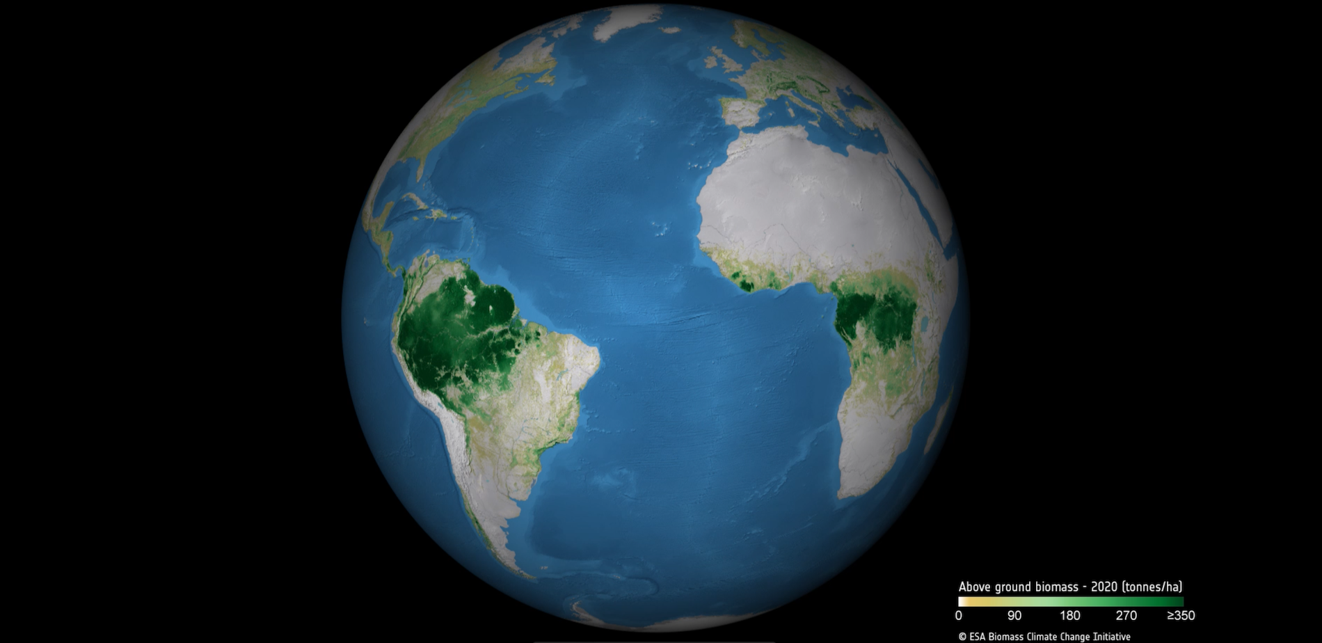
New and improved global maps of above-ground biomass have been released by researchers in ESA’s Climate Change Initiative (CCI), representing a stable and open data source for estimating change in forest biomass over time.
Reliable information to track changes in forest carbon stocks is crucial for robust plans to adapt to and mitigate climate change, which act as ‘the lungs of the Earth’ by absorbing carbon dioxide from the atmosphere and turning it into woody biomass. Recent research has highlighted forests’ vulnerability to degradation from human activities, wildfires and outbreaks of pests and disease.
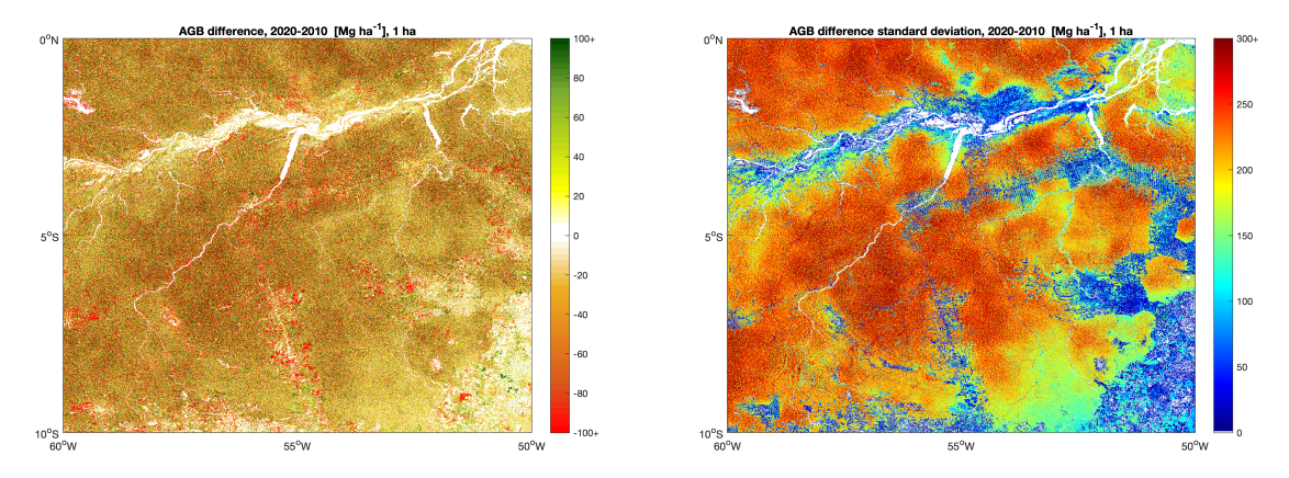
Alongside the new biomass maps, which span eight years in the interval from 2010 to 2021 and include all woody biomes in the world, the team have published change maps for all annual intervals, a decadal interval, and maps are provided at coarser spatial resolutions.
The new CCI Biomass dataset, now in its fifth iteration, includes annual maps for 2010 and annually from 2015 to 2021. The accuracy of the maps has been significantly improved compared to previous versions, with good quality data now available for above-average tropical forest densities, which has been difficult to achieve up until now.

“All eight annual biomass maps have been validated with independent reference data and show a good quality up to 250 t/ha biomass, albeit with some regional variation,” says project scientist Martin Herold of GFZ, Germany. This performs well above the average biomass density in the Amazon forest, which is 170 t/ha. “These new maps are a more stable source for estimating biomass change over time,” says Herold.
The project is working with multiple countries to integrate the CCI Biomass map data into national-level forest monitoring, estimation and reporting in the context of GHG-inventories required under the Global Stocktake of the Paris Agreement, and land degradation neutrality.
The mapping is at 100 m gridding, but spatial resolutions at 1, 10, 25 and 50 km are available to cater for user requirements. Climate and carbon modellers require a global picture at coarse resolution, while national forest managers and agencies responsible for emissions reporting require information at 1 hectare-scale for reporting to the UNFCCC and the UN Reducing Emissions from Deforestation and Forest Degradation (UN-REDD+) Programme.

The research team, led by Richard Lucas of Aberystwyth University in the UK, combined data from a basket of Earth observation satellites to give a wall-to-wall picture of the global forest carbon store. They use Synthetic Aperture Radar data coming from ESA’s Envisat mission, Copernicus Sentinel-1 and’s JAXA’s ALOS and ALOS-2 satellites, with lidar information from ICESat, ICESat-2 and GEDI, assisting with forest height estimates.
“We are really excited to see the new release of the CCI Biomass maps, which is the fruit of a longstanding collaboration between ESA and Japan Aerospace Exploration Agency (JAXA), making excellent use of the ALOS series L-band radar measurements that penetrate the forest canopy,” says Takeo Tadono, research manager of the ALOS mission, JAXA.
Meeting needs for forest-change information
Forest biomass plays an important role in regulating the climate, removing carbon from the atmosphere as vegetation grows and releasing it due to fire, mortality or human impacts due to land use change and deforestation. Monitoring changes in forest biomass is important for forest management, as well as for assessing the impacts of climate change and land use change, and can be used to evaluate models, for example to inform climate mitigation.
Only a few countries use EO-based maps of above-ground biomass for UNFCCC reporting, so the CCI Biomass team has been working with the Committee on Earth Observing Satellites (CEOS) and the Global Forest Observations Initiative (GFOI) to demonstrate how they can be used to generate estimates consistent with policy guidelines for different types of natural forest.
These harmonisation efforts are published on the collaborative open-science cloud computing system, the ESA-NASA Multi-mission analysis and algorithm platform (MAAP).
Going forward, the CCI Biomass project is developing retrieval algorithms to extend the data record as far as possible and to validate their biomass estimates, aiming to produce the most accurate maps possible of above ground biomass and its change, by merging data from different missions, including from future missions such as ESA’s upcoming BIOMASS mission.
Visit the project website here.
The CCI Biomass dataset is available here.
References:
Santoro, M.; Cartus, O. (2024): ESA Biomass Climate Change Initiative (Biomass_cci): Global datasets of forest above-ground biomass for the years 2010, 2015, 2016, 2017, 2018, 2019, 2020 and 2021, v5.01. NERC EDS Centre for Environmental Data Analysis, 22 August 2024.

